Zogg Fire is 100% Contained
This page is no longer being updated due to 100% containment.
- Find Resources and ways to Donate at: 211norcal.org/zogg-fire-resources.
- A printable version of available resources can be found here: Printable Zogg Fire Survivor Resources
On Sunday afternoon, 9/27/20, CAL FIRE responded to the #ZoggFire which started at Zogg Mine Road and Jenny Bird Lane, North of Igo in Shasta County, and spread to the north end of Tehama County.
View Live and Previous Press Conferences at: www.facebook.com/CALFIRESHU.
Please review the following sections to find information.
If you prefer help from a 2-1-1 contact specialist, call 2-1-1, or 855-211-7822.
Page Index
- Fire Survivor Resources and Donations
- Evacuations
- Evacuations Lifted
- Closures
- Fire Information Maps
- Animal Services
- Returning Home After Wildfire
- Sign Up for Alerts
- Be Prepared
- Fire Information
LOCAL ASSISTANCE CENTER:
- Residents impacted by the Zogg fire can find resources and support at the LAC (Local Assistance Center) in Shasta County. Operations will begin October 14 – 21, 10 am – 7 pm at the Shasta District Fair & Event Center (Fusaro Hall).
FIRE SURVIVOR RESOURCES AND DONATIONS
- Find Resources and ways to Donate at: 211norcal.org/zogg-fire-resources.
- A printable version of available resources can be found here: Printable Zogg Fire Survivor Resources
RE-POPULATION/RETURNING HOME:
Coming home after a wildfire can be difficult. As evacuations are lifted please review the safety steps when returning to your home after a wildfire.
ZOGG FIRE – FIRE DAMAGED TREES
When returning to your home, you may have fire damaged trees on your property.
- Be aware of falling branches
- Loose limbs
- Burned-out stumps and holes
- Unstable trees
For information on returning home visit us at https://www.readyforwildfire.org/post-wildfire/returning-home/
For information on rebuilding steps, visit us as www.readyforwildfire.org/post-wildfire/rebuilding
- Upon returning home, residents are urged to complete a safety check of your property to check for damaged trees. Please see: ZOGG DAMAGED TREES ADVISORY.
Health & Hazard Precautions – Shasta County Environmental Health Measures – Zogg Fire
SAFETY MESSAGE:
The public is reminded to stay vigilant on current fire conditions. Please continue to adhere to road closures and any evacuation orders. A reminder to drive slowly and yield to emergency personnel in the area. If at any time you feel unsafe, please call 911. Residents may experience very smokey conditions as the firefight continues. Smokey conditions can be unhealthful to many people especially children, the elderly, and anyone with respiratory problems.
LIFTED EVACUATION ORDERS:
SHASTA COUNTY
Evacuation orders lifted 10/9/20, 5:00 pm:
Zogg Mine Road @ South Fork Road open to residents only for 24 hours
Evacuation orders have been lifted and repopulation is in effect for residents and roadways off of Zogg Mine Rd. All residents entering this area will be required to provide identification and proof of residency.
Evacuation orders lifted 10/6/20, 10:00 am:
Re-population is in effect for residents on Rainbow Lake Rd and all adjoining roadways west of Sunny Hill Rd.
NOTE:The road closure on Rainbow Lake Rd at Sunny Hill Rd will remain in effect for a 24 hour period and will be open to residents only. All residents entering this area will be required to provide identification and proof of residency.
Evacuation orders lifted 10/5/20, 10 am:
- Re-population of South Fork Road, Rainbow Lake Road, Buell Road, Duncan Creek Road, Bully Choop Road, and Old Bully Choop Road.
-
- For details, please see: ZOGG Fire Evac_10.5.20 1000am
-
Evacuation orders lifted 10/4/20, 10 am:
- The following roads along Plantina Rd. between Placer Rd. and Bland Rd. on Deck Way, Junkans Rd, Birdie Ln, Newscott Ln, Nelson Rd, Church St. Cemetery Rd, and Shoup Rd.
- NOTE: Bridal Lane and Spencer Road are open.
Evacuation orders lifted 10/3/20, 10 am:
- Re-population of Placer Road and Foster Road.
- Evacuation and road closure orders have been lifted and a re-population order is in effect for residents
on Placer Road west from Cloverdale Road to the intersection of Platina Road. - Evacuation and road closure orders have been lifted and a re-population order is in effect for residents
on Foster Road and adjoining roadways, west of Gas Point Road.
Evacuation orders lifted 10/2/20, 5 pm:
- Re-population for residences and roadways on the south side of Platina Rd, east from the intersection of Platina Rd and Highway 36 to the Intersection of Platina Rd and Bland Rd.
- Road Closures and evacuation orders will remain in effect for the residences and roadways along the north side of Platina Rd to include Duncan Creek Rd, Bully Choop Rd and Old Bully Choop Rd.
- All other roadways and residences on the north side of Platina Rd west of Bland Rd and east of Highway 36 will be open.
- Platina Rd will remain under evacuation order and closed east of Bland Rd. Access to Platina Rd will be via Highway 36.
Evacuation orders lifted 10/2/20, 11 am:
- The re-population for the town of Platina to include adjoining roadways along the Highway 36 corridor west from the Shasta County and Tehama County line to the Shasta County and Trinity County line. Access to the town of Platina can be made via Highway 36 from Red Bluff or Highway 3 from Hayfork.
- A road closure will remain in effect for westbound traffic on Highway 36 at the intersection of Highway 36 and Highway 3 in Trinity County.
- An evacuation order and roadway closure will remain in effect at Platina Rd east of Highway 36.
Evacuation orders lifted 10/2/20, 10 am:
- The re-population will include all roadways and residences along the corridor of Placer Rd west from Texas Springs Rd to the intersection of Cloverdale Rd. This will include Cloverdale Rd south of Placer Rd to Clear Creek Rd.
- An evacuation order and roadway closure will remain in effect for west bound traffic on Placer Rd west of Cloverdale Rd. Cloverdale Rd is open. Traffic Control Point: Placer Rd @ Cloverdale Rd
- The re-population of residences and roadways as follows: Re-population of all residences along the Clear Creek Rd corridor west of Cloverdale Rd to the intersection of Placer Rd and Gas Point Rd. Re-population of Gas Point Rd and the Lower Gas Point Rd area. This will include all roadways and residences along the corridors of Gas Point Rd and Lower Gas Point Rd north of Foster Rd and south of Clear Creek Rd.
- Evacuation orders and roadway closures will remain in effect on Foster Rd west of Gas Point Rd, Placer Rd north of Platina Rd, and Platina Rd west of Placer Rd.
- An evacuation order and roadway closure will remain in effect for west bound traffic on Platina Rd. An evacuation order and roadway closure will remain in effect for north bound traffic on Placer Rd
TEHAMA COUNTY
Evacuation orders lifted 10/2/20, 10 am:
- Zone H: All areas north of HWY 36 to the Shasta County Line from Vassar Road/Luce Griswald Road and West to Beegum.
Evacuation warnings lifted 10/1/20, 1 pm:
- Zone C 1&2: All areas north of Pettyjohn Road to Hwy 36, east of the Mendocino National Forest boundary
and west of Weemasoul Road/Halley Grade. - Zone E: All areas south of Vestal Road, east of Weemasoul Road, west of Cannon Road/Redd Creek Road
and north of Pettyjohn Road - Zone F 1&2: All Areas north of Halley Grade, west of Vestal Road/Weemasoul Road, and south of Hwy 36
- Zone G: All areas north of Vestal Road from Pope Drive west to Weemasould Road and North to Hwy 36.
RE-POPULATION WARNING:
The Shasta County Department of Agriculture has a message; As residents re-populate the Zogg Fire evacuation zone, they may see an increase in free-roaming livestock and wildlife, including bears. Due to over 56,000 acres being destroyed by the Zogg fire, bears lost much of their natural food sources. They may begin to exhibit more bold or aggressive behavior and may become troublesome around residences. It is
important to not provide food to any wild animal, and not discard any spoiled food outside where wildlife have access.
SAFETY MEASURE:
- If you have an immediate public safety emergency regarding wildlife species, including
bears, please call 911. - If you encounter any non-emergency nuisance wildlife species, contact the Shasta County
Department of Agriculture at 224-4949. - For all domestic animal and livestock issues contact the Shasta County Sheriff’s Office,
Division of Animal Regulations at 245-6540.
CLOSURES/OPENINGS
ROAD CLOSURES
- No road closures are in place.
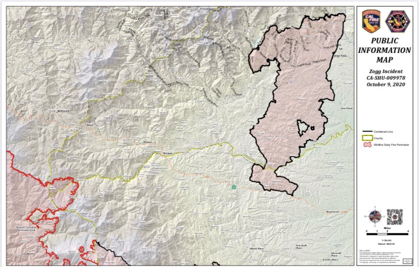
FIRE INFORMATION MAPS – These are to be used to assist as a resource and are not the official fire map.
- TEHAMA PUBLIC WORKS: Tehama.maps.arcgis.com
Map Description: This map shows the Temporary Evacuation Point (TEP) with an easy to identify icon, break-offs are color-coded for city, county, and wildfire perimeters. Color-coded evacuation zones (order – red, warning – yellow, no evacuation – white) are also available using this map. Satellite Thermal Hotspots and Fire Activity are available and updated every 15 minutes. Icons are available for immediate road closures as well as detours, date of when it was updated, official or non-official and from what sources, smoke forecast, a clear legend, straight forward information and is user friendly.
- CITY OF REDDING: Redding.maps.arcgic.com
Map Description: This map shows the Temporary Evacuation Point (TEP) with an easy to identify icon, break-offs are color-coded for city, county, and wildfire perimeters. This map also shows geographical borders. Color-coded evacuation zones (mandatory – purple, order – red, warning – yellow, no evacuation – white) are also available using this map. Approximate NASA Satellites show MODIS Heat Detection within the last 48 hours. The map provides links to resources such as evacuation shelters or temporary evacuation points, large and small animal shelters, as well as PG&E power outages. There is a clear legend for navigating. Offers an evacuation traffic report guiding evacuees on the safest and fastest route out of the area, including traffic incidents as well.
ANIMAL SERVICES
- Cottonwood Rodeo Grounds: Accepting large animals. 3917 Main Street, Cottonwood.
- Redding Rodeo Grounds: Accepting livestock. 715 Auditorium Drive, Redding. See Facebook page for updates: www.facebook.com/ReddingRodeo.
- Haven Humane Society: Accepting small animals (goats, sheep, dogs, cats and other small animals). 7449 Eastside Road, Anderson.
- The Real Cowboy 911 on Facebook might be able to help with evacuations of livestock and pets.
- Shasta County Animal Regulations Office: If animals are not with fire survivor and need to be checked on and/or fed, call a SCAR Officer at 530-245-6065.
SIGN UP FOR ALERTS
- CodeRED Emergency Alert System: Public safety agencies encourage Shasta County residents to register your cell phone with CodeRED so that you can be notified of an emergency situation, such as for evacuations during a fire. (Landlines are automatically notified, but cell phones are not – until you register.) Visit website for information and to register: public.coderedweb.com/CNE/en-US/BFBDCA5E730B
- TehamaAlert Emergency Alert System: Public safety agencies encourage Tehama County residents to register your cell phone so that you can be notified of an emergency situation, such as for evacuations during a fire. (Landlines are automatically notified, but cell phones are not – until you register.) To sign up for TehamaAlert notifications, go to https://bit.ly/3e2viko. You can also sign up by texting the word “SHASTA911” to the number 99411 to receive a mobile link on your cell phone.
BE PREPARED TO EVACUATE
What to bring with you when you evacuate (time permitting):
- Your identification
- Your medications/prescriptions
- Any important documents you might have or need (birth certificates, marriage certificates, insurance policies etc.)
- Any emergency supplies you need, including food and water for a minimum of three days
- Clothes and toiletries
- Pets and pet supplies
For more information, please visit: https://211norcal.org/emergency-preparedness/ or www.readyforwildfire.org
FIRE INFORMATION
Press Releases:
- 10/13/2020, AM Cal Fire Press Release: ZOGG Incident Update AM 10.13.20
- 10/12/2020, AM Cal Fire Press Release: ZOGG Incident Update AM 10.12.2020 _
- 10/11/2020, PM Cal Fire Press Release: ZOGG Incident Update PM 10.12.2020 _
- 10/11/2020, PM Cal Fire Press Release: ZOGG Incident Update PM 10.11.20
- 10/11/2020, AM Cal Fire Press Release: ZOGG Incident Update AM 10.11.20
Official Sources of Information:
- Shasta County Sheriff’s Office Twitter: twitter.com/ShastaSheriff
- CAL FIRE Twitter: twitter.com/CALFIRESHU
- CAL FIRE Facebook: www.facebook.com/CALFIRESHU
- CAL FIRE Website: www.fire.ca.gov/incidents/2020/9/27/zogg-fire
- SHASCOM911: www.facebook.com/Shascom911-764196163637061